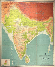
JOHNSTON, W. & A. K. Physical-Political Map of India. Constructed by W. & A. K. Johnston. Edinburgh & London: W. & A. K. Johnston Limited, [c. 1928].
Linen-backed colour-lithographic map, 1310 x 1090 mm, dissected into nine segments; metal grommets in upper margins for hanging; a few small marginal holes, otherwise very good.
A very rare wall map of the Subcontinent for classrooms.
Not in the David Rumsey Collection or listed in WorldCat.
#2123038


